Legend
The symbols of the map’s layers at the view’s scale, over the map view (Android).
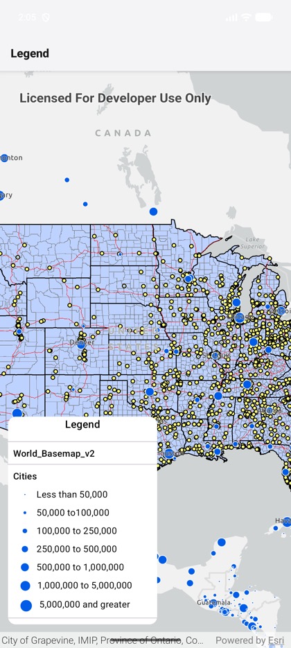
This is the real source of the example app’s toolkit/legend screen — run it on a device
or simulator to see it live.
import { StyleSheet } from 'react-native';import { FeatureLayer, Map, MapImageLayer, MapView } from 'expo-arcgis';import { Legend } from 'expo-arcgis-toolkit';
const USA_MAP_SERVICE = 'https://sampleserver6.arcgisonline.com/arcgis/rest/services/USA/MapServer';const WORLD_CITIES =  'https://sampleserver6.arcgisonline.com/arcgis/rest/services/SampleWorldCities/MapServer/0';
/** * The ArcGIS Toolkit's legend over a map whose layers are declared in JS: a map image layer with * sublayers and a feature layer. It follows the view's scale: zoom in and the layers that only draw * up close join it. Android only; on iOS it renders nothing. */export default function LegendSample() {  return (    <Map basemap="arcGISLightGray" initialViewpoint={{ latitude: 39, longitude: -98, scale: 30_000_000 }}>      <MapImageLayer url={USA_MAP_SERVICE} />      <FeatureLayer url={WORLD_CITIES} />      <MapView style={{ flex: 1 }}>        <Legend style={styles.legend} />      </MapView>    </Map>  );}
const styles = StyleSheet.create({  legend: {    position: 'absolute',    left: 12,    bottom: 36,    width: 230,    height: 320,    borderRadius: 12,    overflow: 'hidden',    backgroundColor: 'white',  },});