Utility network trace
Run named traces from starting points tapped on the map; results in the app’s overlay.
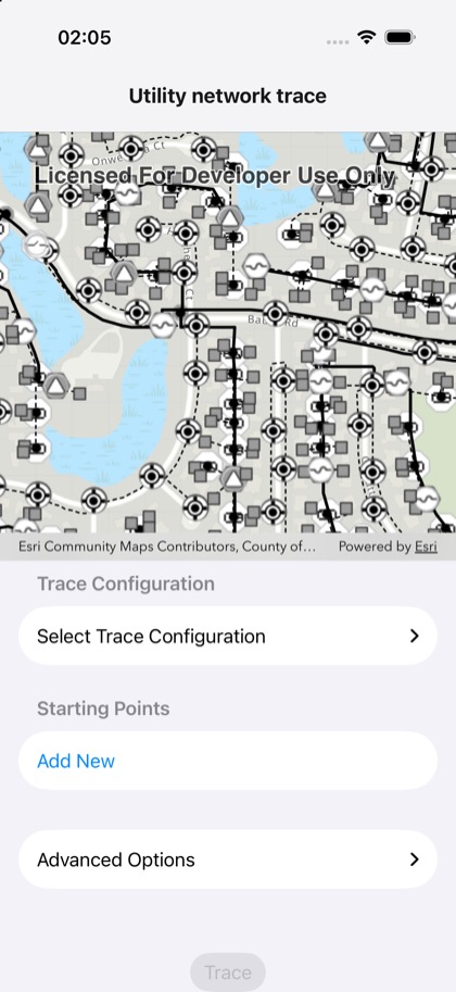
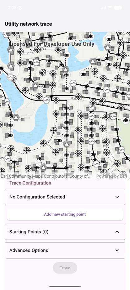
This is the real source of the example app’s toolkit/utility-network-trace screen — run it on a device
or simulator to see it live.
import { useRef, useState } from 'react';import { View } from 'react-native';import {  GraphicsOverlay,  Map,  MapView,  setTokenCredential,  type GraphicsOverlayRef,  type MapViewHandle,} from 'expo-arcgis';import { UtilityNetworkTrace } from 'expo-arcgis-toolkit';
import { UN_LOGIN } from '../../src/utilityNetworkLogin';
// Esri's Naperville electric web map with named trace configurations, as in the Toolkit's// utility network trace example. Its layers are on sampleserver7, behind Esri's public sample login.const UN_WEB_MAP_ID = '471eb0bf37074b1fbb972b1da70fb310';
// The challenge handler signs in with this login when the web map's layers ask for it.setTokenCredential(UN_LOGIN.username, UN_LOGIN.password);
/** * The ArcGIS Toolkit's utility network trace below the map, bound to the `<MapView>` through its * ref. Pick a trace configuration, add starting points by tapping the map (the map view's taps go to * the trace as `mapPoint`), and trace: starting points and results are drawn into the app's overlay. */export default function UtilityNetworkTraceSample() {  const mapView = useRef<MapViewHandle>(null);  const overlay = useRef<GraphicsOverlayRef>(null);  const [mapPoint, setMapPoint] = useState<{ latitude: number; longitude: number } | null>(null);  return (    <View style={{ flex: 1 }}>      <Map portalItem={{ itemId: UN_WEB_MAP_ID }}>        <MapView          ref={mapView}          style={{ flex: 1 }}          onTap={({ nativeEvent }) => setMapPoint(nativeEvent.mapPoint)}        >          <GraphicsOverlay ref={overlay} />        </MapView>      </Map>      <UtilityNetworkTrace        geoView={mapView}        graphicsOverlay={overlay}        mapPoint={mapPoint}        style={{ height: 380, backgroundColor: 'white' }}      />    </View>  );}